
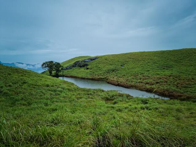
 Hills & TrekkingChembra PeakChembra Peak near Meppadi is the highest peak in Wayanad and one of Kerala's best-known regulated trekking landscapes.…Explore profile →
Locality · District geography
Kottavayal
Kottavayal is a named locality on the Thrikkaipetta side of Meppadi panchayat in Wayanad. It is a settled neighbourhood associated with the Puthurvayal postal area.
Geography source linkedLast checked: Not independently checked · Source available
Discover Locality
About Kottavayal
Administrative and geographical information about this area, separate from business or office records.
Kottavayal is a small neighbourhood on the Thrikkaipetta–Puthurvayal side of Meppadi grama panchayat. The locality is closely connected to the roads and community spaces that serve Puthurvayal and the villages towards Kalpetta. This side of Wayanad is made up of several neighbouring settlements, each with a name that residents use for homes and meeting places. Thrikkaipetta, with its bamboo-craft tradition, provides a wider village landmark. Kottavayal has its own identity within the residential landscape, making the name helpful for finding local destinations rather than only the nearest larger town.
Also recorded asKottavayal (Thrikkaipetta)
Local profile
Kottavayal at a glance
Geographical identifiers, not a postal delivery address or an establishment listing.
Geographical classificationLocality
DistrictWayanad
TalukVythiri
Associated PIN673577
Recorded parent areaThrikkaipetta
PIN associations are reference information. Confirm the delivery post office for a complete postal address.
Geographical reference (not a mailing address)Kottavayal, Vythiri, Wayanad, 673577
Getting around
Access and transport
Puthurvayal is a useful postal and road reference for the Kottavayal area.
Explore the area
Local highlights
Neighbourhood routes connecting Kottavayal with Puthurvayal and Thrikkaipetta.
Explore the PIN area
Tourist locations linked to PIN 673577
Discover recorded tourism profiles sharing this PIN association. This is not a distance or municipal-boundary estimate.
Hills & TrekkingChembra PeakChembra Peak near Meppadi is the highest peak in Wayanad and one of Kerala's best-known regulated trekking landscapes.…Explore profile → WaterfallsSoochipara WaterfallsSoochipara Waterfalls, also called Sentinel Rock Waterfalls, is a dramatic three-tier cascade near Vellarimala and Meppadi in Wayanad.…Explore profile →
Useful local information
Location profiles in PIN 673577
Explore separately maintained schools, offices, hospitals, institutions and other listings with this PIN association. Their contact details live on their individual Location pages.
Connected geographical records
Other areas sharing PIN 673577
Quick answers
Questions about Kottavayal
What kind of geographical place is Kottavayal?
Kottavayal is recorded as a locality in Wayanad district, Vythiri taluk.
Which PIN is associated with Kottavayal?
The recorded PIN association is 673577. For postal delivery, verify the applicable post office and full address.
Where can I find services or tourist places linked to Kottavayal?
Explore separately maintained Tourism and Location profiles sharing PIN 673577 using the discovery sections on this page. PIN sharing does not establish geographical proximity.
Trust and transparency
Source and geographical context
Geographical names, administrative links and PIN associations may change. Submit a correction for editorial review, not an office contact number.
Open recorded geographical reference ↗