
Village · District geography
Kanjirangad
Kanjirangad, also written Kanhirangad, is a revenue village in Mananthavady taluk, Wayanad, with official village-office correspondence routed through Makkiyad PIN 670731.
Official source linkedLast checked: See source for current information · Source available
Discover Village
About Kanjirangad
Administrative and geographical information about this area, separate from business or office records.
Kanjirangad has a distinct revenue-village identity in northern Wayanad. The state Revenue Department places it in Mananthavady taluk and lists the village office at Makkiyad, with PIN 670731. That makes the Kanjirangad name relevant to addresses which might otherwise mention only Makkiyad, Vanhode or the larger Thondernad panchayat. Its administrative record gives a geographical area of 3,546 hectares and identifies Thondernad as its grama panchayat in an earlier reference. The variation Kanhirangad also appears in district and election records, so both spellings should lead to this single record. The village should not be collapsed into neighbouring Thondernad revenue village merely because they participate in the same panchayat.
Also recorded asKanhirangad · Kanjiragad
Local profile
Kanjirangad at a glance
Geographical identifiers, not a postal delivery address or an establishment listing.
Geographical classificationVillage
DistrictWayanad
TalukMananthavady
Associated PIN670731
PIN associations are reference information. Confirm the delivery post office for a complete postal address.
Geographical reference (not a mailing address)Kanjirangad, Mananthavady, Wayanad, 670731
The local setting
Landscape and geography
The Revenue Department records a total geographical area of 3,546 hectares for Kanjirangad revenue village.
Getting around
Access and transport
Makkiyad is the postal address of the Kanjirangad village office under 670731.
Explore the area
Local highlights
Makkiyad and Vanhode are particularly useful address references in the Kanjirangad part of the postal area.
Before you explore
Helpful visitor information
Kanjirangad is a revenue village; Thondernad is the name of the grama panchayat identified in its Revenue Department profile.
Explore the PIN area
Tourist locations linked to PIN 670731
Discover recorded tourism profiles sharing this PIN association. This is not a distance or municipal-boundary estimate.
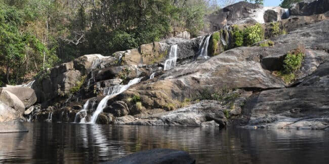 WaterfallsMakkiyad Meenmutty WaterfallsMakkiyad Meenmutty Waterfalls is a forest-fringed cascade near Makkiyad and Thondernad in northern Wayanad. Reached through the green…Explore profile →
Useful local information
Location profiles in PIN 670731
Explore separately maintained schools, offices, hospitals, institutions and other listings with this PIN association. Their contact details live on their individual Location pages.
Connected geographical records
Other areas sharing PIN 670731
Quick answers
Questions about Kanjirangad
What kind of geographical place is Kanjirangad?
Kanjirangad is recorded as a village in Wayanad district, Mananthavady taluk.
Which PIN is associated with Kanjirangad?
The recorded PIN association is 670731. For postal delivery, verify the applicable post office and full address.
Where can I find services or tourist places linked to Kanjirangad?
Explore separately maintained Tourism and Location profiles sharing PIN 670731 using the discovery sections on this page. PIN sharing does not establish geographical proximity.
Trust and transparency
Source and geographical context
Geographical names, administrative links and PIN associations may change. Submit a correction for editorial review, not an office contact number.